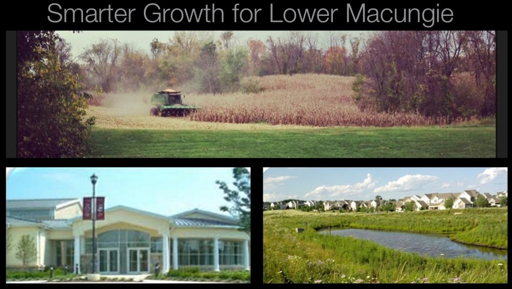
In the coming weeks the township will be considering an official map. This is something I support since the official map tool greatly increases the likelihood that key conservation resources are protected.
Designation of a Official Map allows a municipality the ability to delay development of a property for up to a year so the municipality can inquire about acquisition of the property for preservation or other public uses outlined by a comprehensive plan.
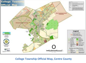
An “official map” is an ordinance and map designed to carry out a community vision set forth in comprehensive plans. As a preservation tool the teeth of the official map lie in the powers granted by the state which give a community essentially what amounts to as a “pause” button. This can be used when poorly planned development contrary to the comprehensive plan is proposed on land designated on the map. The map outlines planned future public lands and facilities including transportation, parks, trails, and preserved open space. By utilizing the “pause” button functionality of the map the township gives itself the ability to delay a poorly planned development proposal for up to one year. This gives us valuable time to investigate acquisition or preservation. Another way to put it is the map represents a “first dibs” option on an identified piece of land for public use.
Currently, 65 municipalities in 15 counties utilize official maps. Locally, Upper Milford and Upper Saucon have adopted map ordinances. I believe it is one of the critical 3 tools that Lower Macungie needs to pursue an aggressive preservation program. The 3 tools are:
- Comprehensive planning – To outline priorities. We have these.
- Official map – To protect outlined priorities from bad development proposals by giving the township time to negotiate when faced with a poor development proposal.
- Funding mechanism – To acquire or purchase development rights. Purchasing development rights or outright acquisition is the only fair way to preserve farmland and open space.
According to the MPC, and a little common sense designating a property on the official map does not constitute a taking. This is a concern sometimes expressed by developers and landowners. The official map doesn’t take property it just gives us the opportunity to negotiate purchase or preservation of a property before poorly planned development occurs. It is up to individual municipalities how best to accomplish goals. In most cases it happens through fair market compensation. Exceedingly rare is it for a municipality to ever use condemnation. When it does come up it’s usually to secure new roadway right of way. It’s not something I would ever support.
Nuts & Bolts:
1. Reserving land for future public use on an official map does not affect the property’s ownership. Landowners still own and control their land.
2. The “pause button” is only invoked if a poor development proposal is made on a property on the official map and the proposal is counter to comprehensive planning.
3. After notification of intent is sent by the township the powers granted by the state allow them one year to act. During the one year time span, the municipality may opt to put together a plan to acquire or preserve the land.
4. In the vast majority of cases acquisition or preservation is accomplished by paying fair market value. This is the only fair and permanent way to preserve.
5. The municipality also maintains the option to not acquire or preserve the property and allow for the property owner to move forward with proposed development plans. However, the official map can be an effective negotiation tool that the township can use to encourage a better more friendly proposal. It can help to ensure development – when it occurs – is compatible with and supportive of community goals.
Local example Upper Milford: Our neighbors to the South in Upper Milford have an adopted official map. Recently, they had a land development proposal for 200 units on a property off Mill Rd. Since the property is on the townships official map and the township expressed interest the project can now be delayed one year as Upper Milford investigates preservation options. It’s unknown whether they will or not, but what’s key is the ability to have time to explore options. If Upper Milford decides not to acquire the property, the development proposal can move forward as planned. The township can also negotiate a much more community friendly proposal like a true conservation cluster project using the acquisition leverage of the official map.